Land Registry Boundaries in Rural Areas: What Rural Property Owners Need to Know
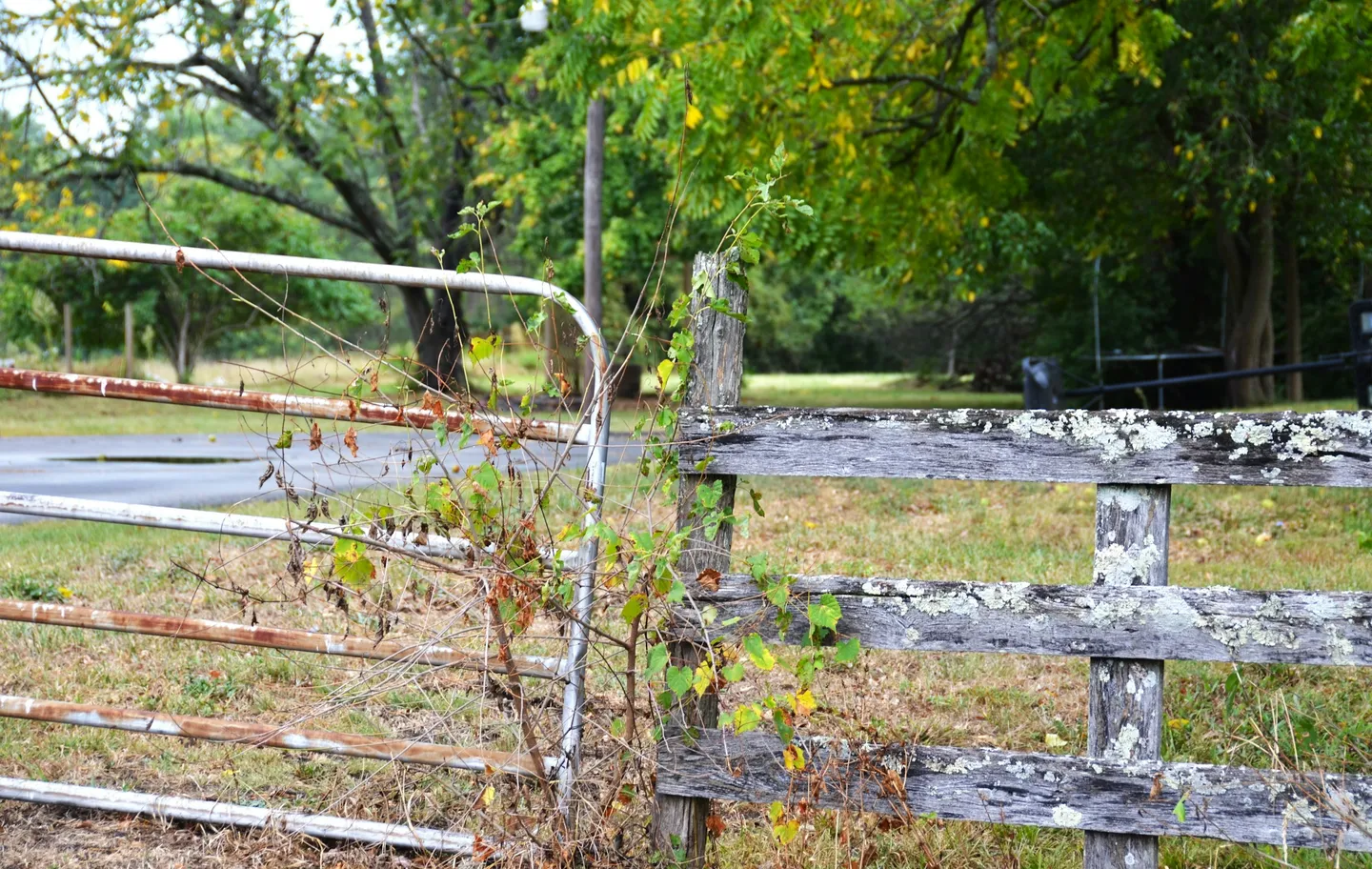
Photo by Roger Starnes Sr on Unsplash
The red line on your Land Registry title plan doesn’t mark your actual boundary. It shows only the “general” position, potentially leaving metres of land in legal uncertainty. This fundamental principle catches rural property owners off guard repeatedly, sparking disputes over hedgerows, ditches, and field edges that have defined farmland for centuries.
Different systems govern how boundaries are recorded across England, Wales, Scotland, and Northern Ireland. Each has distinct rules, costs, and procedures. For anyone buying, selling, or managing rural property, understanding these systems provides essential protection against disputes that routinely cost tens of thousands of pounds to resolve.
The general boundaries principle
The cornerstone of English and Welsh land registration is the general boundaries principle. Section 60(1) of the Land Registration Act 2002 states that boundaries shown on title plans indicate only the “general position” and explicitly do not determine the exact legal boundary line. This isn’t a flaw in the system but a deliberate design choice reflecting practical reality.
Legal boundaries are invisible, theoretical lines with no thickness whatsoever. Mapping millions of such precise boundaries would be prohibitively expensive and, given that most historical deeds describe boundaries imprecisely, often impossible. The red edging line on your title plan, when scaled up, represents approximately 0.3 to 0.6 metres on the ground at rural scales. Sometimes this line is wider than the entire area being disputed.
Court of Appeal decisions have reinforced how much uncertainty this creates. In Drake v Fripp [2011], judges confirmed there is “no limit to the quantity of land that can fall within the scope of the general boundaries rule,” even strips exceeding 1.5 acres. More recently, Clapham v Narga [2024] involved combined legal costs exceeding £300,000 over land merely 2 to 5 metres in depth, with the Court of Appeal reiterating that title plans remain indicative only.
Title plan limitations in rural settings
Title plans are based on Ordnance Survey mapping available at registration time, using different scales depending on location. Urban areas typically use 1:1,250 scale where the line width represents roughly 0.3 metres on the ground. Rural areas commonly use 1:2,500 scale where the line width represents approximately 0.6 metres. Large rural areas may use 1:5,000 scale (1.2 metres) and mountain or moorland areas 1:10,000 scale (2.4 metres on ground).
For rural properties, smaller scales mean greater inherent uncertainty. The red line is drawn following the inside of physical boundary features shown on OS mapping, but those features may have changed since registration, been surveyed imprecisely, or never accurately represented the legal boundary in the first place.
HM Land Registry doesn’t routinely update title plans when physical features change. Your neighbour’s title may be based on a different OS map edition entirely, creating apparent overlaps or gaps that exist only on paper.
Registered versus unregistered land
Approximately 86% of freehold land in England and Wales is now registered, but significant portions of rural, agricultural, and ecclesiastical property remain unregistered. The difference matters considerably for boundaries.
Registered land benefits from state guarantee of title, online searchability, and clearer boundary information, though still imprecise under the general boundaries rule. Adverse possession requires the 10-year rule with owner notification under the Land Registration Act 2002.
Unregistered land requires tracing ownership through original title deeds, offers no state guarantee, and remains subject to the older 12-year adverse possession rule under the Limitation Act 1980. This makes it easier for others to claim your land through long use. Registration becomes compulsory within two months of any transfer for value, gift, first legal mortgage, or grant of lease exceeding seven years.
Scotland’s cadastral mapping system
Scotland operates a fundamentally different system through Registers of Scotland under the Land Registration etc. (Scotland) Act 2012. Unlike England’s general boundaries approach, Scotland aims to map precise legal boundaries on a statutory cadastral map, though accuracy remains limited by OS mapping tolerances.
The Keeper’s Warranty replaces the older indemnity system. The Keeper warrants title accuracy to applicants but can limit or exclude warranty where uncertainty exists. Properties must be mappable on the cadastral map for registration, meaning deeds must describe boundaries sufficiently for precise delineation.
Title sheets must show area measurements for plots of 0.5 hectares or larger. The cadastral map cannot show overlapping cadastral units, so boundaries must be definitively resolved. Many rural Scottish properties remain on the General Register of Sasines, Scotland’s pre-registration system dating from 1617, with verbal boundary descriptions rather than mapped boundaries.
First registration requires acceptable mapping, making voluntary registration advisable before sale to control how boundaries are defined. Current Scottish fees for 2024-2025 range from £60 for properties up to £50,000 (£45 for voluntary registration with 25% discount) to £1,000 for properties over £2,000,000 (£750 voluntary). Processing typically completes within 35 working days for standard applications, though complex cases can take six months.
Northern Ireland’s folio system
Land & Property Services administers Northern Ireland’s Land Registry under the Land Registration Act (Northern Ireland) 1970. The system uses a three-part folio structure comprising Property (location, description, area, rights attached), Ownership (registered owner, title quality, restrictions), and Burdens (mortgages, rights of way, covenants).
Rural properties in Northern Ireland were often among the first registered due to historic Land Purchase Acts requiring registration for land purchase transactions. The general boundary principle applies here as well. Section 64(1) states that “the description of any land in the register shall not be conclusive as to the boundaries or extent of the land.”
Registration fees for 2024-2025 range from £90 standard (£70 electronic) for properties up to £5,000 to £1,025 standard (£1,005 electronic) for properties over £1,000,000. Contact the Land Registration Helpline at 0300 200 7803 or email [email protected].
Establishing actual boundary positions
Since title plans don’t show exact boundaries, establishing the true legal line requires examining multiple evidence sources, often going back centuries for rural properties. When courts determine boundaries, they consider evidence in roughly this order of weight: original conveyance documents, plans attached to original conveyances (not subsequent title plans), verbal descriptions in deeds supplementing plans, historical maps such as tithe maps and enclosure awards, physical features on the ground at the time of original conveyance, legal presumptions like the hedge and ditch rule, and current physical features which receive the least weight since features move over time.
Historical documents that establish boundaries
Tithe maps and apportionments from 1836 to the 1850s provide the first systematic mapping survey of most English and Welsh parishes. Created under the Tithe Commutation Act 1836, they show individual plots with ownership, tenancy, land use, and field names. Approximately 1,900 “first-class” maps were certified as accurate enough for legal boundary evidence. Second-class maps vary from near-accurate to rough sketches.
Enclosure awards and maps, mainly from 1760 to 1820, recorded the redistribution of common land during the Parliamentary enclosure movement, affecting roughly 21% of England. They show field boundaries, roads, public footways, and drainage, often providing the earliest detailed survey of a parish. Estate maps commissioned by landowners from the 16th to 20th centuries vary in scale, detail, and purpose but can provide crucial evidence of historic boundary positions.
These documents are held at The National Archives in Kew, County Record Offices, and for registered land sometimes as filed plans with HM Land Registry.
Physical features as boundary evidence
Hedgerows serve as living boundary records. Dr Max Hooper’s dating rule suggests counting woody species in a 30-metre stretch, with each species representing approximately 100 years. A hedge with four species is roughly 400 years old. This rule of thumb requires corroboration with documentary evidence and is unreliable for hedges over 1,000 years old.
Dry stone walls cover over 200,000 kilometres across Britain. Some date to the Bronze Age though most visible walls derive from 18th and 19th century enclosures. Regional distribution concentrates in the Highland Zone, including the Yorkshire Dales where 8,000 kilometres were surveyed in 1988 alone, the Peak District, Lake District, Cornwall, Wales, and Scotland.
Ditches and banks provide evidence for applying the hedge and ditch rule. Man-made ditches were typically dug at property edges, with excavated soil thrown onto the digger’s own land to form a bank, often topped with a hedge.
The hedge and ditch rule
This ancient legal presumption, established in Vowles v Miller (1810), operates where properties are divided by a hedge and ditch combination. The rule presumes the ditch was dug after the boundary was established, the landowner stood at their boundary edge facing their own land, they dug the ditch at the very edge of their land, excavated soil was thrown onto their own land forming a bank, and a hedge was planted on this bank.
Therefore, the boundary runs along the far edge of the ditch from the hedge, meaning both hedge and ditch belong to the land on the hedge side. The Court of Appeal confirmed this rule’s continuing relevance in Parmar v Upton [2015], noting that a full hedge isn’t required and that a line of mature trees showing a former hedge line suffices. However, the presumption can be rebutted by evidence that the ditch predated the boundary, is natural rather than man-made, or that both sides were in common ownership when the ditch was dug.
Natural boundaries and watercourses
Ad medium filum aquae presumes that boundaries along non-tidal rivers and streams run down the centre line of the water. Each riparian owner owns half the riverbed. If the watercourse changes gradually and naturally over time through accretion or diluvion, the boundary moves with it. Sudden changes from floods or human intervention don’t affect the boundary position.
Tidal boundaries follow the mean high water mark, which is the average between spring and neap tides. The foreshore between high and low water marks is presumed Crown property. Lakes wholly within a parcel belong to the landowner. Lakes between different ownerships have no presumption, and documentary evidence determines ownership.
Applying for a determined boundary
The only way to establish an exact, legally fixed boundary on the Land Register is through a determined boundary application under Section 60 of the Land Registration Act 2002. This replaces the general boundary with a surveyed, recorded line.
Consider applying when neighbours agree on boundary position and want to prevent future disputes, when development or construction requires precision at the boundary, following expert determination or court judgment of boundary position, or when significant investment is planned near the boundary. HM Land Registry does not resolve boundary disputes. It only records where the exact line has been identified through agreement, expert determination, or court order.
Application requirements
Form DB is required regardless of how many boundaries are being determined. The application must include a precisely surveyed plan that shows the boundary extent with colouring or edging, identifies start, end, and turning points with letters (A-B-C-D), includes verbal description relating the line to physical features, is drawn to stated scale preferably no smaller than 1:200, shows sufficient surrounding detail for OS identification, is signed by applicants, and contains no disclaimers like “for identification only.”
Measurement requirements demand accuracy to within 10 millimetres. Measurements must be taken horizontally, not along slopes, from at least two defined points on permanent features, with a surveyor’s certificate confirming accuracy required. If National Grid coordinates are used, absolute accuracy must be within 300 millimetres, relative accuracy within 10 millimetres, using eight-digit metric coordinates with Easting first.
Supporting evidence establishing the exact boundary line should include plans and provisions from pre-registration deeds, statutory declarations or statements of truth, expert surveyor reports, and boundary agreements with adjoining owners if available.
Costs and processing times
For 2024-2025, a determined boundary application using Form DB costs £90 with no reduction for electronic submission. Official copies of title register or plan cost £7 electronic or £11 postal. Title plan historical editions cost £7 electronic or £11 postal.
The Registrar serves notice on adjoining owners unless a written agreement or court order is lodged. If objections arise that cannot be resolved, the matter is referred to the First-tier Tribunal (Property Chamber). Where neighbours want to agree a boundary, mutual transfers using Form TP1 of any land either side plus a request to determine the boundary under Rule 122 requires only the transfer fee, not the £90 DB fee.
Common causes of boundary disputes in rural areas
Unclear title plans remain the primary source of conflict. When both parties have title plans showing the same boundary in different positions, both legitimately issued by Land Registry based on different OS editions or different registration dates, each genuinely believes they’re correct.
Physical versus registered boundaries create confusion when fences, hedges, or walls don’t align with title plans. Features erected for livestock management, convenience, or informal agreement may never have reflected legal ownership. Gradual encroachment occurs through ploughing patterns pushing cultivation boundaries outward, hedge removal for field enlargement, or ditch maintenance altering water flow and apparent boundaries.
Historical ambiguities compound problems when pre-registration deeds contain vague descriptions, use outdated reference points, or reference field parcel numbers that no longer correspond to current features.
Adverse possession under current law
The Land Registration Act 2002 significantly changed adverse possession rules for registered land, making it harder to claim another’s property through long use.
After 10 years’ adverse possession, the squatter may apply to be registered as proprietor. Land Registry notifies the registered owner and interested parties. The owner has 65 business days to respond. If the owner serves counter-notice, the application is rejected unless one of three conditions is met: proprietary estoppel where it would be unconscionable to dispossess the squatter, other entitlement where the squatter has another reason to be registered such as inheritance or uncompleted purchase, or boundary dispute where the squatter possessed adjacent land for 10 or more years under reasonable mistaken belief they owned it and the exact boundary has never been determined.
If the initial application fails due to counter-notice but the squatter remains in possession for two more years, they can reapply, and registration proceeds unless the owner has taken action to evict. Brown v Ridley [2025] UKSC clarified that the 10-year period doesn’t have to be the most recent 10 years before application. Any qualifying period suffices. This makes it easier for landowners to claim land used under genuine boundary mistakes.
Other legal presumptions
Beyond the hedge and ditch rule, courts apply several presumptions. Ad medium filum viae presumes that owners of land abutting roads also own the soil beneath the highway to its centre line. The highway authority owns only the surface under Section 263 of the Highways Act 1980.
Fence posts facing inward creates a weak presumption that the fence belongs to the owner on that side, based on traditional practice of erecting fences on one’s own land with posts facing inward. This is easily rebutted by documentary evidence. For railways, the boundary is the railway fence, not the track centre, per the Railways Clauses Consolidation Act 1845.
Dispute resolution without litigation
Boundary litigation frequently costs £20,000 to £100,000 or more and can exceed the land’s value many times over. Alternative resolution methods deserve serious consideration.
Direct discussion between neighbours, supported by independent review of deeds and title plans, resolves many disputes at minimal cost. An informal surveyor consultation costing £300 to £800 can clarify positions before emotions escalate.
Mediation and expert determination
The RICS Neighbour Disputes Service offers a hybrid expert determination and mediation approach. The evaluation stage costs approximately £1,500 plus VAT. The negotiation stage costs approximately £1,950 plus VAT. Fees are typically shared between parties. The PLA/RICS Mediation Service launched in 2025 specifically addresses boundary disputes. General civil mediators charge day rates of £1,000 to £3,500, often split between parties.
Parties can jointly appoint an expert, typically a chartered surveyor, who produces a binding determination of boundary position. Per Jones v Murrell [2016], parties are bound by the expert’s award even if arguably mistaken. Expert surveyor fees run £1,500 to £5,000 plus legal advice on instruction terms costing £500 to £1,500.
Boundary agreements
Neighbours can record agreed boundary positions through formal boundary agreements. White v Alder [2025] EWCA Civ confirmed these agreements bind successors in title even without their knowledge, significantly strengthening their value.
A boundary agreement doesn’t require land transfer formalities if it merely identifies where the boundary already lies. If substantial land transfer is involved, compliance with Section 2 of the Law of Property (Miscellaneous Provisions) Act 1989 becomes necessary, meaning a written contract signed by both parties. Register agreements with HM Land Registry via Form AP1 for permanent record on both titles.
Court proceedings
If alternative resolution fails, disputes may proceed to the First-tier Tribunal (Property Chamber), which handles matters referred from Land Registry applications including adverse possession objections and determined boundary disputes. The panel consists of three members: a legal member, surveyor, and lay person. Site inspection is typical and free mediation is offered. The tribunal is less formal than court and parties can self-represent.
The County Court handles disputes not involving Land Registry applications, including trespass and encroachment claims. The Pre-Action Protocol requires information exchange and alternative dispute resolution exploration before proceedings.
Realistic cost estimates for 2024-2025 show solicitor initial assessment running £1,000 to £3,000, negotiated settlement with solicitor involvement £5,000 to £15,000, expert surveyor report £750 to £2,000, expert witness fees for litigation £2,000 to £5,000, and full County Court litigation £20,000 to £100,000 or more. Peck v Ranford (2023) awarded just £200 damages for minor wall trespass after the parties incurred £130,000 in costs. The judge criticized the “sledgehammer to crack a nut” approach, but the costs stood.
Rights of way across rural land
Public rights of way recorded on definitive maps create specific obligations. You must keep routes visible and unobstructed, as obstruction is a criminal offence. Maintain stiles and gates at your expense, though 25% or more may be claimable from the highway authority. Field-edge footpaths and bridleways cannot be cultivated. Cross-field paths must be restored within 14 days after first disturbance and 24 hours after subsequent cultivation. Bulls of dairy breeds over 10 months are banned from fields with rights of way.
Scotland differs fundamentally. The Land Reform (Scotland) Act 2003 creates universal “right to roam” access across most land for responsible non-motorised recreational use, not limited to registered paths.
Private easements, which are rights of way over your land benefiting neighbouring properties, may be express (formally granted), implied (arising from circumstances), or prescriptive (acquired through 20 or more years’ uninterrupted use “without force, secrecy, or permission”).
Fencing responsibilities
No general legal obligation to fence boundaries exists in the UK. However, the Animals Act 1971 makes livestock owners strictly liable for damage caused by straying animals, regardless of negligence. As Williams v Hawkes [2017] confirmed: “A farmer is responsible for fencing against his own stock.”
T-marks on title plans indicate maintenance responsibility only where the deed text expressly refers to them. T-marks not referenced in deed text have no special legal meaning.
Positive fencing covenants requiring maintenance don’t automatically bind successors in title under common law. They require formal arrangements like deed restrictions or chain of indemnity covenants to ensure continuing obligation.
Common land
Approximately 400,000 hectares in England, representing 3% of land area, is registered common land, accounting for one-third of all moorland. Commons are owned by one or more persons, but “commoners” hold rights to use the land including grazing (pasturage), taking timber (estover), cutting peat (turbary), and fishing (piscary).
Section 38 of the Commons Act 2006 requires consent for any “restricted works” on common land, including erecting fences, constructing buildings, or digging ditches. Driving vehicles on common land without lawful authority is a criminal offence. Boundaries with commons may not align with physical features, and many registration errors from the original 1965 process remain unresolved. Check the Commons Register held by local authorities for registered boundaries, rights, and owners.
Ransom strips
Ransom strips, sometimes as narrow as 150 millimetres, between properties and public highways can be deliberately retained when selling development land, created through historic conveyancing gaps, or arise from description errors.
Stokes v Cambridge [1961] established a starting point of one-third of development value uplift, though actual ransom payments can reach 50% depending on circumstances. To identify ransom strips before purchase, order an Index Map search to reveal gaps, compare title plans carefully against physical access, walk the site with registered extent overlay, and contact the council for adopted highway extents.
Mineral rights
Land ownership extends to the subsoil, but mineral rights are frequently severed. The state owns coal (virtually all unworked coal), oil and gas (Crown owns petroleum in natural state), and gold and silver (Crown as “Mines Royal”). All other minerals are privately owned, often reserved in Victorian and Edwardian deeds or retained through manorial rights.
Development implications are significant. Foundation works, piling, and service installation may trespass on mineral owners’ property. Star Energy v Bocardo [2009] confirmed actionable trespass even at depth, creating potential ransom situations.
Pre-purchase due diligence
Essential searches beyond the standard suite include Local Authority search (LLC1/CON29) for rights of way, commons, tree preservation orders, and highways. Order an Index Map search using SIM form to identify gaps, ransom strips, and extent verification. Check Commons Registration for rights over or affecting land. In relevant areas, obtain mining searches for coal, tin, or other mineral workings. Environmental searches cover contamination and flood risk. Check for chancel repair liability, which are historic church repair obligations.
Documentary red flags demanding investigation include boundaries marked “general boundary only,” registered notices regarding disputes, missing filed plans from original registration, inconsistent measurements across documents, T-marks without deed explanation, and mines and minerals reservations.
Physical concerns include boundary features not matching title plan, evidence of moved fences or hedges, new boundary structures, visible encroachments, no physical demarcation of boundaries, and water features that may have shifted. Occupational concerns include neighbours using land apparently within title, tracks crossing the property, multiple users of apparent private road, and third-party storage or parking.
Title indemnity insurance
Where boundary issues cannot be resolved before completion, title indemnity insurance can cover financial loss from defects. Policies are available for boundary positions inconsistent with physical features, boundary structures owned by third parties, potential future boundary disputes, and missing boundary agreements.
Key limitations include that policies are invalidated if defects are disclosed to third parties, they don’t remedy the underlying problem but only compensate for loss, and premiums reflect assessed risk. Leading providers include First Title, DUAL Corporate Risks, and Countrywide Legal Indemnities.
Current fees and contacts
HM Land Registry for England and Wales charges registration fees from December 2024 ranging from £20 portal/electronic (£45 postal) for properties up to £80,000 to £500 portal/electronic (£1,105 postal) for properties over £1,000,000. Determined boundary applications cost £90 regardless of submission method. Official copies of register or plan cost £7 electronic or £11 postal. Adverse possession applications cost £130.
Processing times as of October 2025 show 83.5% of applications completed within one day. Complex first registrations take 9 to 13 months. Expedite service is available free with most processed within 10 working days. Contact HM Land Registry at 0300 006 0411 or through customerhelp.landregistry.gov.uk.
Registers of Scotland processes approximately 85.6% of applications within 35 working days. Contact them at 0800 169 9391 or [email protected] or visit ros.gov.uk.
Land & Property Services for Northern Ireland can be reached at 0300 200 7803 or [email protected]. Their LandWeb Direct portal is at portal.landwebni.gov.uk.
When to involve professionals
Involve a solicitor early when documentary title is unclear or incomplete, a neighbour is uncooperative, encroachment has occurred, adverse possession is claimed or suspected, formal Land Registry applications are needed, or property sale is affected by boundary uncertainty. Hourly rates run £150 to £400 depending on region. Initial consultations typically cost £300 to £800.
RICS-regulated boundary specialists can produce accurate measured surveys to within 10 millimetres for determined boundaries, analyse historical evidence and apply legal presumptions, prepare CPR Part 35-compliant expert witness reports, and certify determined boundary applications. Advisory reports cost £750 to £2,000. Determined boundary plans cost £1,500 to £3,000. Expert witness attendance runs £1,000 to £2,500 per day. Use the RICS “Find a Surveyor” service to locate specialists in boundary demarcation and disputes.
Protecting your interests
Land Registry boundaries in rural areas operate on fundamentally different principles than most property owners assume. The general boundary rule means your title plan provides only approximate indication of extent, potentially leaving significant land in legal uncertainty. Historical evidence, legal presumptions, and careful investigation often matter more than the red line on your registered plan.
Prospective buyers should conduct thorough pre-purchase due diligence. Walk boundaries with title plans, investigate historical documents, examine physical features, and don’t assume fences or hedges mark legal boundaries. Commission appropriate searches and consider specialist survey where doubt exists.
Current owners should document boundaries thoroughly with dated photographs and maintain copies of all title documents. Communicate with neighbours before any boundary-related changes. Consider formal boundary agreements to prevent future disputes. The £90 determined boundary application fee compares favourably to £20,000 to £100,000 or more in litigation costs.
Those facing disputes should explore alternative resolution before committing to litigation. Mediation and expert determination resolve many disputes at a fraction of court costs. When professional help is needed, instruct specialists early. Solicitors familiar with property boundary law and RICS-regulated boundary surveyors bring expertise that generalists lack.
The boundaries dividing rural properties have evolved over centuries through enclosure, cultivation, and natural change. Understanding how the law interprets these divisions, and what evidence proves ownership, protects both the land itself and the certainty that comes from knowing where your property truly ends.